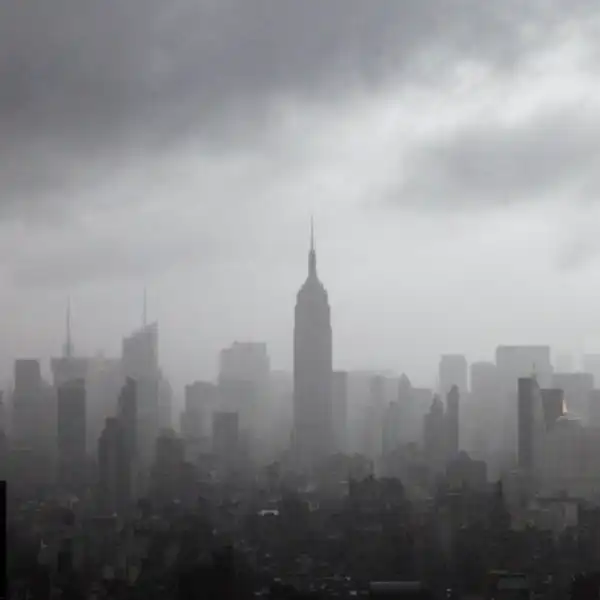
Short Answer

Both the model and the market expect rain in NYC on Apr 5, 2026, with no compelling evidence of mispricing.

1. Executive Verdict

  • Neutral ENSO conditions are highly likely for March-April-May 2026.
  • April precipitation trends for Central Park could not be determined.
  • Winter 2025/Spring 2026 large-scale climate patterns are projected.
  • Atlantic Multidecadal Oscillation influences North Atlantic ocean temperature variability.
  • Long-lead April 2026 precipitation forecasts are not yet available.

Who Wins and Why

Outcome Market Model Why
Rain in NYC 99.0% 97.7% Rain is widely expected for this date.

2. Market Behavior & Price Dynamics

Historical Price (Probability)

Outcome probability
Date
This market has demonstrated a complete lack of volatility, with a perfectly sideways price trend. The probability of a "YES" outcome has remained fixed at 99.0% throughout the trading period, across all recorded data points. Consequently, there have been no significant price spikes or drops to analyze. The chart establishes a single, definitive price point at 99.0%, which has acted as both the absolute support and resistance level. This flat line indicates an unwavering and unanimous consensus from the market's inception.
With a total volume of 4,044 contracts traded, the market has seen some activity, but none of it has been substantial enough to challenge the prevailing price. This pattern suggests that while shares are being exchanged, the participants are in complete agreement on the outcome's high probability. The market sentiment is exceptionally strong and stable, reflecting an overwhelming conviction that it will rain in NYC on the specified date. The absence of any price movement suggests no new information has been introduced that could cause traders to question this near-certain outlook.

3. Market Data

View on Kalshi →

Contract Snapshot

A "Yes" resolution occurs if Central Park, NYC records precipitation strictly greater than 0 inches on April 05, 2026, including 'Trace' (T) or 'Record' (R) values where the record is strictly greater than zero. A "No" resolution occurs if precipitation is exactly 0 inches and does not meet these 'Trace' or 'Record' criteria. The market expires by April 12, 2026, or sooner based on data release, with the NWS Climatological Report NY serving as the primary verification source, switching to an NWS time series if the report is inconclusive.

Available Contracts

Market options and current pricing

Outcome bucket Yes (price) No (price) Last trade probability
Rain in NYC $1.00 $0.01 99%

Market Discussion

Traders are discussing the market's resolution rules regarding "Trace" (T) amounts of precipitation. One user questioned a previous "Yes" resolution for "Trace" precipitation on March 30, 2026, citing past inconsistencies. However, another user clarified that the explicit market rules state that an Expiration Value of 'T' (Trace) or 'R' (Record) will resolve this market to 'Yes', provided the value is strictly greater than zero.

4. What is the Long-Range ENSO Forecast for March-April-May 2026?

ENSO Forecast (MAM 2026)Neutral ENSO conditions (IRI/CPC, NMME) [^]
NYC April Precipitation (Neutral ENSO)No strong or consistent anomaly, trending average (CPC) [^]
Average NYC April PrecipitationApproximately 4.47 inches (113.5 mm) (Central Park) [^]
The long-range dynamic model consensus from the IRI/CPC and the NMME projects a high likelihood of Neutral ENSO conditions for the March-April-May (MAM) 2026 season [^] . At such an extended lead time, approximately two years from current operational forecasts, predictability for specific El Niño or La Niña states significantly decreases. This often leads multi-model ensembles and consensus forecasts to converge towards climatological averages or neutral conditions, as long-range forecasts typically revert to Neutral given the limited skill at these very long ranges [^].
Historically, Neutral ENSO conditions generally correlate with average April precipitation in New York City (NYC). During Neutral ENSO phases, April precipitation in NYC does not exhibit a significant or consistent anomaly, tending towards average conditions [^]. According to the Climate Prediction Center's (CPC) ENSO composites, regions in the Northeast United States, including NYC, show no strong tendency for either above-average or below-average precipitation during April under Neutral ENSO conditions [^]. For context, the average April precipitation recorded at Central Park, NYC, is approximately 4.47 inches (113.5 mm) [^].

5. Can Central Park April Precipitation Trends Be Determined (2000-2024 vs. 1970-1999)?

Specific Precipitation Trend (1970-1999 vs. 2000-2024)Cannot be determined from provided research (web research results [^])
Average April Precipitation Days (>0.01 inch)11.0 days (1991-2020 normals [^])
Probability of "Wet Day" (early April >0.04 inches)29% (not specific to comparison periods or 'trace' threshold [^])
The specific statistical trend could not be determined. The provided research materials do not contain the necessary raw daily precipitation data or pre-calculated frequencies to compare 'trace' or greater precipitation days for Central Park (Station USC00305801) during April 1-7 between the 2000-2024 and 1970-1999 periods [^]. A precise comparative statistical analysis is not possible with the currently available information.
Conducting this analysis requires specific daily precipitation data. To perform this type of analysis, daily precipitation records, including trace amounts, would need to be extracted for April 1-7 for each year within both the 1970-1999 and 2000-2024 periods. This data is typically sourced from databases like the Global Historical Climatology Network daily (GHCNd), maintained by the National Centers for Environmental Information (NCEI) [^]. Once the necessary data is compiled, the frequency for each period could be calculated and subsequently compared to identify any significant trend.
General April precipitation patterns are available for Central Park. While the specific comparative trend remains unavailable, general information indicates that Central Park averages 11.0 days with precipitation exceeding 0.01 inch in April, based on 1991-2020 normals [^]. Furthermore, the probability of a "wet day" (defined as at least 0.04 inches of precipitation) in Central Park tends to decrease from 29% at the beginning of April to 26% by the month's end, although this information does not directly apply to the requested comparison periods or the 'trace' precipitation threshold [^].

6. What Climate Conditions Are Forecasted for Winter 2025/Spring 2026?

Primary ENSO PhaseDeveloping La Niña (Winter 2025/Spring 2026) [^]
Pacific Decadal OscillationNegative Phase (Winter 2025/Spring 2026) [^]
North Atlantic OscillationLargely Negative (Winter 2025/Spring 2026) [^]
Winter 2025/Spring 2026 anticipates specific atmospheric and oceanic conditions. The large-scale climate pattern for this period is projected to feature a developing La Niña, a negative phase of the Pacific Decadal Oscillation (PDO), and a North Atlantic Oscillation (NAO) that is predominantly negative, though with potential for brief positive excursions [^]. These factors represent the expected atmospheric and oceanic states.
Five historical years are identified as climate analogs for this period. Based on these projections, historical climate indices since 1950 identified 1974, 1976, 1989, 2008, and 2011 as analog years. These years shared similar characteristics, including La Niña, negative PDO, and frequently negative NAO conditions during their respective winter and early spring seasons [^].
April 5th precipitation in New York City varied across these analogs. Precipitation outcomes for New York City on April 5th during these analog years ranged from no precipitation, with 0.00 inches recorded in 1989 and 2008, to moderate rainfall of 0.40 inches in 1976. Trace amounts of precipitation were also recorded in 2011 [^].

7. What is the current Atlantic Multidecadal Oscillation phase?

AMO Fluctuation Duration20-40 years [^]
AMOC Weakening TrendSince 1960 [^]
Current AMO Phase StatusNot explicitly stated in research [^]
The Atlantic Multidecadal Oscillation (AMO) describes North Atlantic ocean temperature variability. The AMO is a natural variability mode in the North Atlantic Ocean, characterized by long-duration fluctuations in sea surface temperatures, typically lasting 20 to 40 years [^]. While several sources provide access to historical AMO index data and explain its nature [^], the provided research does not explicitly state the AMO's current phase. Determining the exact current phase would necessitate direct access to live data feeds from external websites [^]. Related research also indicates a sustained weakening of the Atlantic Meridional Overturning Circulation (AMOC) since 1960, which is connected to AMO variability [^].
Research lacks specific details on NYC weather system frequencies by AMO phase. The provided research does not contain specific information regarding the historical frequency of coastal low-pressure systems versus inland frontal systems impacting New York City in early April. Furthermore, it does not detail how these frequencies might differ between positive (warm) and negative (cool) AMO phases. The available sources primarily focus on the AMO index itself, its definition, and broader ocean climate overviews, rather than regional weather pattern frequencies or their direct correlation with AMO phases for NYC in early April [^].

8. What is the Skill of Long-Lead Weekly Precipitation Forecasts for April 2026?

CFSv2 April 2026 Forecast ReleaseJuly 2025 (9-month lead) [^]
SEAS5 April 2026 Forecast ReleaseSeptember 1, 2025 (7-month lead) [^]
Skill for Weekly Precipitation AnomaliesNot statistically significant at long lead times [^]
Seasonal forecast models will begin releasing April 2026 forecasts in late 2025. NOAA's Climate Forecast System version 2 (CFSv2) is expected to make its forecasts for April 2026 publicly available around July 2025, offering a 9-month lead time [^]. Following this, ECMWF's Seasonal Forecast System 5 (SEAS5) will issue its initial forecasts covering April 2026 approximately on September 1, 2025, providing a 7-month lead [^]. Both models offer monthly updates, with their respective lead times progressively decreasing as the forecast period approaches.
However, these models exhibit significant limitations regarding precipitation predictive skill. Both CFSv2 and SEAS5 are designed to project seasonal mean climate anomalies rather than specific weekly precipitation anomalies [^]. As a result, they do not show statistically significant skill for weekly precipitation anomalies at extended lead times. For the related metric of seasonal mean precipitation anomalies in the Northeastern U.S. during the March-April-May (MAM) season, statistically significant skill is very restricted and typically does not extend beyond a 0-1 month lead for either model [^]. Research also suggests that precipitation predictability, especially over the eastern U.S., commonly has limits of one month or less [^].

9. What Could Change the Odds

Key Catalysts

Catalyst analysis unavailable.

Key Dates & Catalysts

  • Expiration: April 12, 2026
  • Closes: April 06, 2026

10. Decision-Flipping Events

  • Trigger: Catalyst analysis unavailable.

12. Historical Resolutions

Historical Resolutions: 20 markets in this series

Outcomes: 13 resolved YES, 7 resolved NO

Recent resolutions:

  • KXRAINNYC-26APR04-T0: YES (Apr 05, 2026)
  • KXRAINNYC-26APR03-T0: YES (Apr 04, 2026)
  • KXRAINNYC-26APR02-T0: YES (Apr 03, 2026)
  • KXRAINNYC-26APR01-T0: YES (Apr 02, 2026)
  • KXRAINNYC-26MAR31-T0: YES (Apr 01, 2026)